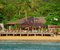
|
We have 3 types of chalets: - Standard, Superior and Deluxe.
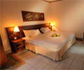
All rooms are sea facing with private balcony and are air-conditioned with hot water bathroom attached.
Each room can accommodate up to 4 person (3 adults or 2 adults & 2 child).
It also includes tea/coffee making facilities and a cable television.
Our Superior chalet comes with a queen-size bed and a double pull out sofa bed.
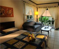
Deluxe chalets comes with a queen size bed in the bedroom (separated) and a double pull out sofa bed in the living room.
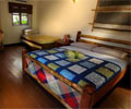
Standard chalet has a queen size bed and 2 single pull out beds.
|